A Wave That Rewrote the Record Books
When millions of tonnes of rock came crashing down into an Alaskan fjord last year, it didn't just make a splash — it triggered one of the most powerful tsunamis ever recorded on Earth. A new study has confirmed the wave reached a staggering 481 metres in height, surpassing the tallest viewing platform of Toronto's iconic CN Tower.
To put that in perspective: the CN Tower stands 553 metres total, with its main observation deck sitting around 346 metres. This wall of water was taller than most skyscrapers ever built.
What Caused It
The tsunami was triggered by a massive landslide in a remote Alaskan fjord — a narrow, steep-sided inlet carved by ancient glaciers. When the rock face gave way and fell roughly one kilometre into the water below, the displacement was catastrophic. The sheer volume and velocity of the falling debris sent a megatsunami rippling outward at terrifying speed.
Megatsunami events like this differ from the seismic tsunamis most people picture. Rather than being caused by an underwater earthquake shifting tectonic plates, they're generated by the sudden mass displacement of water — think a massive rock dropped into a bathtub, scaled up by several orders of magnitude.
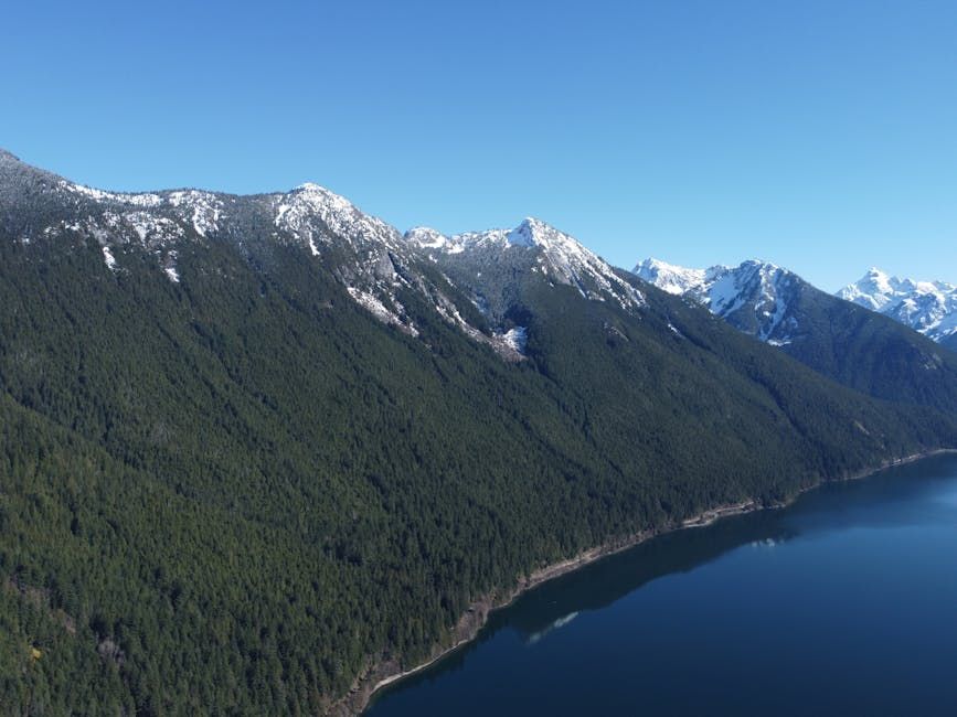
Why British Columbia Is Paying Attention
The findings aren't just a remote curiosity — they're a direct warning for Canada's own coastline. British Columbia shares striking geographic similarities with the affected Alaskan region: deep fjords, towering coastal mountains, and steep slopes that have been quietly destabilized by decades of glacial retreat driven by climate change.
As glaciers recede, they expose and undercut rock faces that were previously held in place by ice. The result is an increasingly unstable landscape where the conditions for a similar landslide-driven wave are quietly building along B.C.'s coastline.
Communities in areas like the Haida Gwaii archipelago, the Inside Passage, and remote fjord-adjacent towns could face risk from such events — though scientists emphasize the challenge is knowing when these slopes might give way.
Monitoring and Preparedness
Researchers and emergency planners are calling for improved monitoring of high-risk slope areas along the B.C. coast. Advances in satellite imaging and ground-based sensors are making it increasingly possible to track small movements in unstable terrain before they become catastrophic failures.
Canada's Pacific coastline is no stranger to seismic risk — the Cascadia Subduction Zone running off B.C.'s shore is considered one of the most dangerous fault lines on the continent. But landslide-generated waves represent a different, and in some ways harder to predict, category of hazard.
A Rare but Real Threat
Megatsunamis are extraordinarily rare, but the evidence from Alaska is a stark reminder that they do happen — and that the right combination of terrain, instability, and a triggering event can produce destruction on an almost unimaginable scale.
For B.C. coastal planners, the lesson from Alaska is clear: the mountains lining those stunning fjords deserve as much attention as the waters below them.
Source: CBC News / CBC Technology