Ottawa Bracing for Peak Flood Conditions This Week
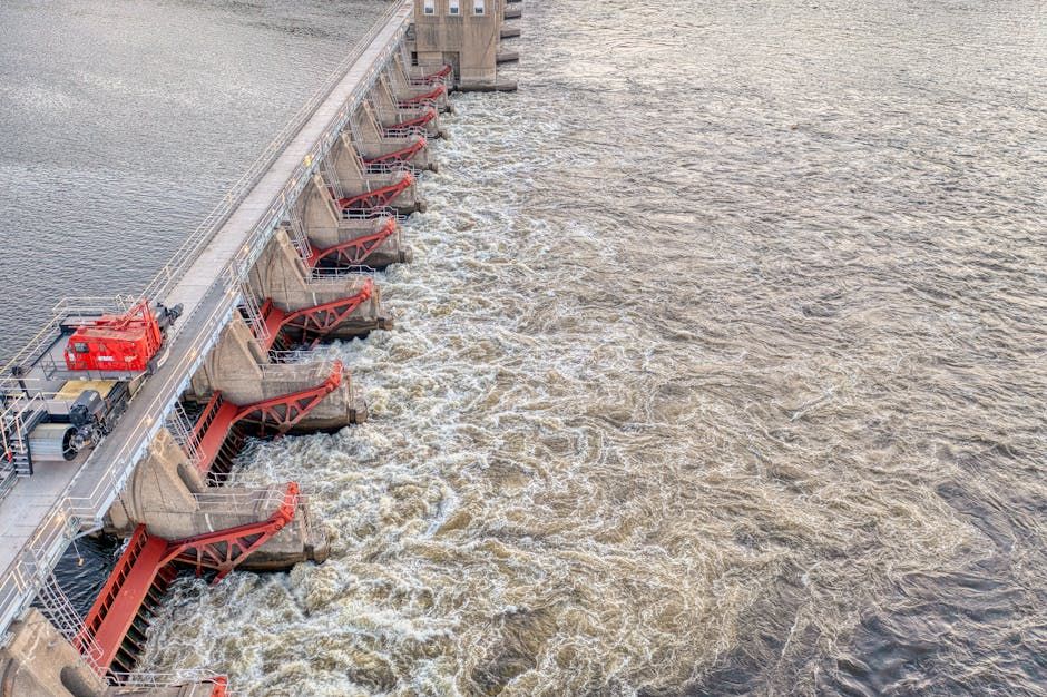
Ottawa is facing a significant flooding threat this week as a combination of heavy rainfall and unseasonably warm temperatures has pushed water levels in the region to dangerous heights. Emergency officials are closely monitoring conditions as water levels are expected to peak sometime Monday or Tuesday, putting communities along the Ottawa River and surrounding waterways on high alert.
Both Ottawa and Gatineau — the Quebec city that sits directly across the river — are under threat, making this a cross-provincial emergency situation that local authorities are managing together.
What's Causing the Flooding?
The culprit is a familiar one for Ottawa-area residents: the spring melt season colliding with significant rainfall. Warm temperatures have accelerated snowmelt in the upper Ottawa River watershed, and the rain that's fallen over recent days has compounded the volume of water making its way downstream. When these two forces combine, the Ottawa River and its tributaries can swell rapidly — which is exactly what's happening right now.
This is not Ottawa's first rodeo with spring flooding. The region saw major flood events in 2017 and 2019 that caused widespread property damage and forced hundreds of evacuations. Authorities say they are drawing on lessons learned from those events as they coordinate the current response.
Which Areas Are Most at Risk?
Low-lying communities along the Ottawa River are the most vulnerable. In past flood years, neighbourhoods like Constance Bay, Cumberland, Rockcliffe Park, and parts of Gatineau's Île-des-Allumettes have been hit hardest. Residents in flood-prone areas should stay informed and be prepared to act quickly if evacuation orders are issued.
The City of Ottawa and the Ottawa River Regulation Planning Board are monitoring water levels around the clock. Sandbag distribution sites may be activated depending on how conditions develop — check the City of Ottawa's official website and social media channels for the latest updates.
What Should Ottawa Residents Do Right Now?
If you live in or near a flood-prone area, here's what emergency preparedness officials recommend:
- Monitor local alerts — Sign up for Ottawa's emergency alert system and keep an eye on updates from the National Capital Commission and the Ottawa River Regulation Planning Board.
- Prepare a go-bag — Have essentials like documents, medications, phone chargers, and a few days of supplies ready to grab if you need to leave quickly.
- Stay off flooded roads — Even shallow water on roadways can be deceptive and dangerous. Never drive through standing water.
- Move valuables to higher ground — If you have a basement or ground-floor storage, move important belongings upstairs now.
- Check on neighbours — Elderly residents and those with mobility challenges may need extra help if conditions worsen.
When Will It Get Better?
Authorities expect water levels to peak Monday or Tuesday before gradually receding, but the timeline depends heavily on whether additional rainfall hits the region. Residents should plan for conditions to remain unstable through the middle of the week at minimum.
Ottawa has faced these challenges before and come through them — neighbours helping neighbours, city crews working through the night, and communities rallying together. That spirit is already showing up again this spring.
Stay safe, Ottawa. Keep checking official city channels for the most current information.
Source: Ottawa Citizen