Ottawa's Annual Spring Flood Season Is Here
Ottawa residents living near the Ottawa River know this time of year well: as snow melts across the upper watershed and temperatures climb, the river swells, spills its banks, and reminds the city who was here first.
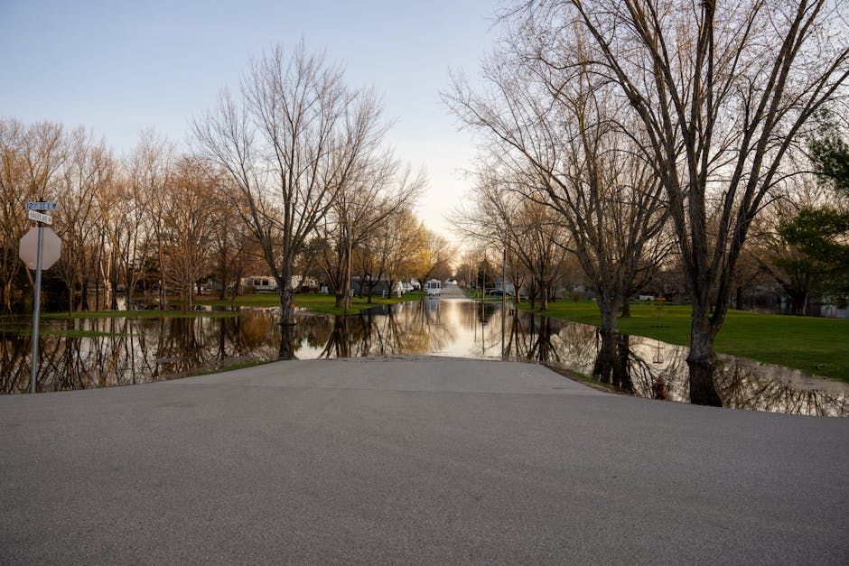
This spring's flooding is drawing attention once again, with CBC capturing striking images of the rising waters along the Ottawa River corridor. From submerged docks and half-drowned trees to flooded roadways and sandbag lines, the photos paint a vivid picture of what shoreline communities deal with every year.
Why the Ottawa River Floods Every Spring
The Ottawa River drains one of the largest watersheds in eastern Canada — roughly 146,000 square kilometres stretching deep into Quebec and Ontario. Every spring, snowmelt from that massive area funnels into the river system at once. Combine that with ice jams, spring rain events, and saturated ground that can't absorb any more water, and you get the seasonal surge Ottawa has come to expect.
The Ottawa River Regulation Planning Board monitors water levels year-round and issues outlooks to help communities prepare. But even with modern forecasting, the river's scale means flooding can be difficult to fully control.
Communities on the Front Lines
Neighbourhoods and communities along the Ottawa River — including Constance Bay, Britannia, and areas bordering Gatineau across the river — are among those most affected during high-water years. Residents in flood-prone zones often spend early spring monitoring daily water level updates, positioning sandbags, and making difficult calls about whether to stay or temporarily relocate.
For many, it's a routine that's become second nature. Longtime riverside residents know the warning signs: ice moving in the channel, water creeping up the lawn, the familiar smell of river silt on the air.
A Bittersweet Spectacle
For all the disruption it causes, Ottawa River flooding also draws onlookers. The sight of the river in full spring fury — wide, fast, and powerful — is undeniably striking. Trails that were dry just weeks ago sit under a foot of water. Boats bob where parking lots used to be. The floodplain ecology actually depends on these periodic inundations to sustain the wetlands, waterfowl habitat, and riparian vegetation that make the river corridor so ecologically rich.
CBC's ongoing photo coverage gives those who can't visit the river a front-row seat to how the season is unfolding — and serves as a record of just how significant this year's flood event is shaping up to be.
What to Do If You're Affected
If you live near the river or in a flood-prone area, the City of Ottawa's emergency management resources and the Ottawa River Regulation Planning Board's website are the best places to check for up-to-date outlooks and flood preparation guidance. The National Capital Commission also posts trail closures as river levels change.
Stay safe out there, Ottawa — and maybe keep the sandbags handy a little while longer.
Source: CBC Ottawa via Google News RSS