Ottawa is no stranger to spring flooding, but this year's Ottawa River rise has once again reminded residents just how powerful — and humbling — the natural world can be.
Over the past week, CBC reporters and videographers fanned out across the Ottawa-Gatineau region to document the flooding as it unfolded in real time. The images they captured tell a vivid story: submerged streets, waterlogged backyards, and the slow, creeping advance of the river into communities that have been through this before.
A Region on Watch
The Ottawa River, which forms the border between Ontario and Quebec, is one of the most flood-prone waterways in Eastern Canada. Each spring, snowmelt from the vast Ottawa River watershed — stretching deep into Quebec and northern Ontario — funnels downstream, causing water levels to swell.
This year's flooding has affected communities on both the Ontario and Quebec sides of the river. Residents in areas like Constance Bay, Cumberland, and Gatineau's Pointe-Gatineau neighbourhood — all veterans of past flood seasons — have been keeping a close eye on water levels and preparing accordingly.
What the Photos Show
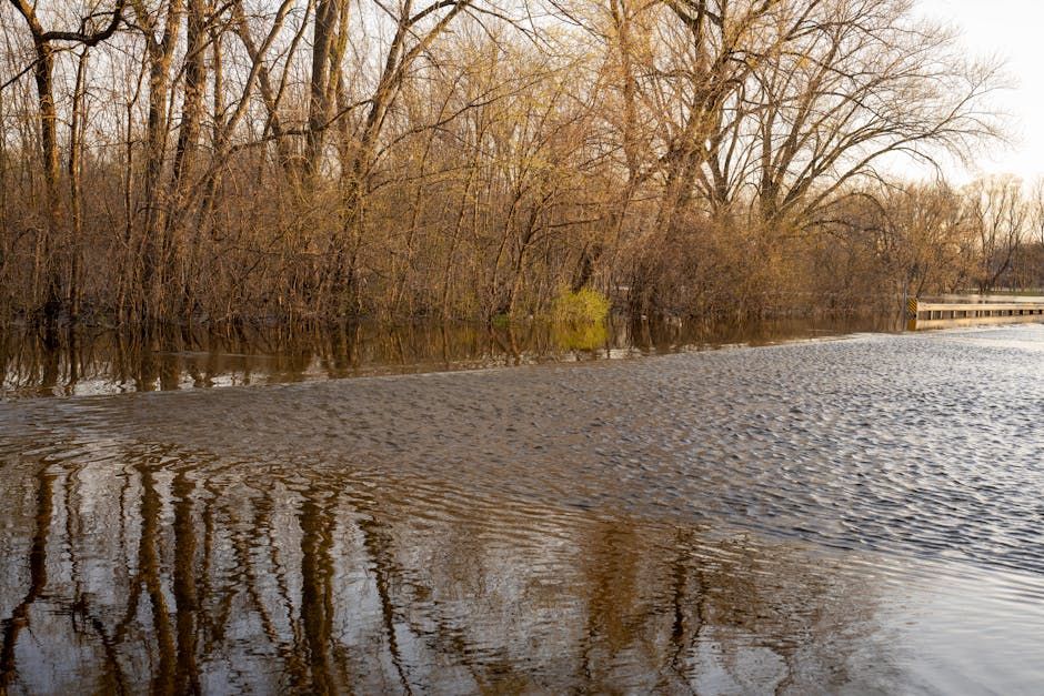
The CBC's on-the-ground coverage painted a striking picture of life along the swollen river. Familiar streets disappeared under murky brown water. Sandbag barriers, stacked by residents and city crews in the days prior, stood as quiet testaments to the community's hard-earned flood preparedness.
In some riverside neighbourhoods, docks floated well above their usual height. Parks and pathways that in drier months attract joggers and dog walkers were completely underwater. The images serve as a powerful visual record of what spring in the Ottawa Valley can look like when the river has other plans.
Ottawa's History With Flooding
The 2019 flood remains the benchmark — a devastating event that forced hundreds of Gatineau and Ottawa-area residents from their homes, caused millions of dollars in damage, and led to years of debate about flood plain management, buyout programs, and what climate change means for the region's future.
Since then, the City of Ottawa and the National Capital Commission have invested in flood mitigation measures, and many residents in the most vulnerable areas have taken their own precautions — elevating electrical systems, installing sump pumps, and signing up for emergency alerts.
What to Do If You're Affected
If you live near the river and are concerned about rising water levels, the Ottawa River Regulation Planning Board publishes regular updates on water levels and forecasts. The City of Ottawa also maintains flood resources on its website, including sandbag pickup locations when conditions warrant.
For those not directly in harm's way, the images coming out this week are a reminder of the resilience of Ottawa-area communities. Year after year, neighbours help neighbours — stacking sandbags, moving belongings to upper floors, and keeping an eye out for those who need a hand.
Spring flooding is a reality of life along the Ottawa River. But so is the community spirit that rises to meet it.
Source: CBC Ottawa. Photos by CBC reporters and videographers in the Ottawa-Gatineau region.