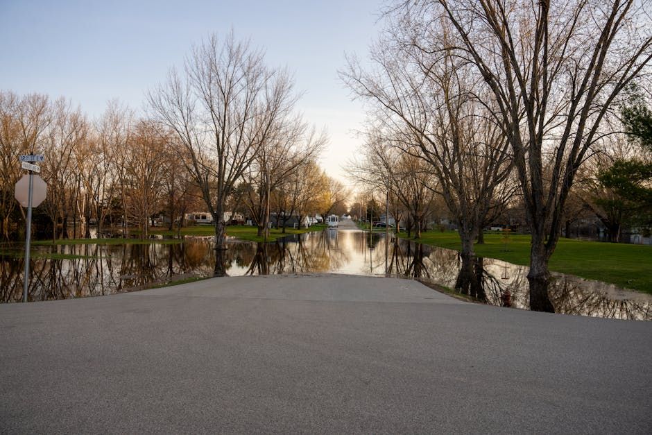
Ottawa River on the Rise This Spring
Ottawa residents in flood-prone areas are keeping a close eye on the Ottawa River this week, as water levels and flows continue to rise along the river's main stem. The Ottawa River Regulation Planning Board confirmed in its latest Saturday update that the increase is being driven by a combination of melting snow and runoff from recent rainfall — a one-two punch that's putting pressure on the region's flood management systems.
It's the kind of spring scenario that Ottawa has faced before, and one that demands a coordinated, around-the-clock response from municipalities, conservation authorities, and provincial agencies.
What's Driving the Rise
Spring flooding on the Ottawa River is nothing new. The river's massive watershed — stretching across Quebec and Ontario — collects snowmelt from a wide area, and when rainfall hits on top of already-saturated ground, water has nowhere to go but downstream.
The Ottawa River Regulation Planning Board, which coordinates dam operations across the watershed, has been actively managing outflows to try to reduce peak water levels downstream. Operators adjust releases from upstream reservoirs to buffer the flood pulse as much as possible, but there are limits to what the system can absorb when the entire basin is shedding water at once.
Work on the Ground
Across the Ottawa region, crews have been mobilizing to protect vulnerable properties and infrastructure. That means sandbagging along riverbanks, monitoring pump stations, and keeping a close watch on low-lying roads and properties in communities like Cumberland, Constance Bay, and Britannia — areas that saw significant flooding in 2017 and 2019.
Local municipalities have been coordinating with the City of Ottawa and provincial emergency management officials, with public updates being issued regularly so residents know what to expect and when to act.
For homeowners near the river, the advice is familiar: move valuables to upper floors, know your evacuation route, and stay informed through official channels.
How This Compares to Past Floods
Ottawa has endured some punishing spring floods in recent memory. The 2017 and 2019 floods caused hundreds of millions of dollars in damage across the region and forced thousands of residents from their homes. Those events accelerated conversations about long-term flood mitigation — including permanent dike improvements, voluntary buyouts for the most vulnerable properties, and updated floodplain mapping.
Whether this spring reaches those levels remains to be seen. Forecasters will be watching upstream conditions, soil saturation levels, and the weather forecast closely over the coming days.
What to Watch For
The Ottawa River Regulation Planning Board updates its forecasts regularly during high-water events. Residents in flood-prone areas should monitor those updates, along with advisories from the City of Ottawa and local conservation authorities.
If you're unsure whether your property is in a flood-risk zone, the City of Ottawa's floodplain maps are available online. And if conditions worsen, don't wait for an official order — take early action to protect your home and family.
This is a developing situation. Stay tuned to local updates as conditions evolve over the coming week.
Source: CBC Ottawa