Ottawa River Flooding Update: What Residents Need to Know
The Ottawa River is continuing to rise northwest of Pembroke, while conditions downstream remain stable — a split picture that has local communities and emergency management officials keeping a close eye on water levels this spring.
The upper reaches of the Ottawa River, particularly the stretches northwest of Pembroke, are seeing sustained increases in water levels. This section of the river is highly sensitive to snowmelt and spring runoff from the Laurentian Highlands and surrounding watershed, which can cause rapid fluctuations especially during April and May.
Upstream vs. Downstream: A Tale of Two Rivers
While the situation northwest of Pembroke remains in flux, downstream communities along the Ottawa River — including areas closer to Ottawa itself — are currently reporting stable conditions. That distinction matters enormously for the hundreds of thousands of people who live and work near the river corridor.
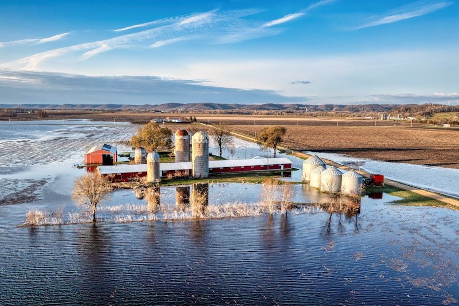
Spring flooding along the Ottawa River is a recurring concern for many communities. In previous high-water years, riverside properties from Pembroke all the way down to the Ottawa-Gatineau area have seen significant impacts, with some homeowners dealing with flooded basements, blocked roads, and damaged docks and boathouses.
Environment and Climate Change Canada regularly issues flood watches and warnings for the Ottawa River watershed during the spring melt season. Residents in low-lying areas or on the river's floodplain are encouraged to monitor official advisories and prepare accordingly.
What to Watch For
Flooding risk along the Ottawa River is shaped by several factors, including:
- Snowpack depth in the upper watershed and northern Ontario
- Rate of snowmelt, which can accelerate dramatically with warm temperatures and rain
- Ice jam conditions, which can cause sudden and severe localized flooding
- Reservoir management by the Ottawa River Regulation Planning Board, which coordinates water releases across the system
The Ottawa River Regulation Planning Board manages water levels at multiple dams across the watershed and plays a key role in moderating flood peaks — but even with active management, extreme spring conditions can overwhelm the system's capacity to buffer high water.
Stay Informed and Prepared
For Ottawa-area residents, now is a good time to review your flood preparedness plan, particularly if you live near the river or in a known floodplain area. Keep an eye on updates from the City of Ottawa, the National Capital Commission, and provincial emergency management authorities.
Residents in Renfrew County and the Pembroke area should follow local municipal advisories closely and heed any evacuation or access restriction notices that may be issued as water levels are assessed in coming days.
The situation is being actively monitored, and conditions can change quickly during the spring thaw. Check back for further updates as the Ottawa River flooding picture develops across the watershed.
Source: CBC Ottawa via Google News Ottawa RSS feed.