Ottawa Kids Are Walking Across Canada's Waterways — Literally
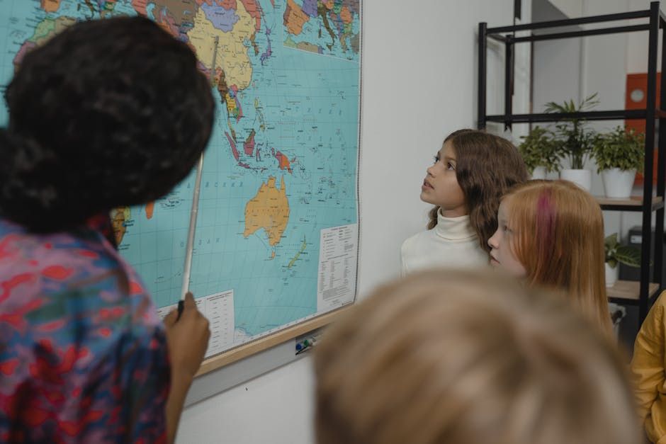
Ottawa students are among the young Canadians diving into a fascinating new water literacy program that's making geography and environmental education feel less like a lecture and more like an adventure. At the heart of it: a massive floor map that lets kids physically walk across the rivers, lakes, and watersheds that define Canada's freshwater landscape.
The program, reported by CBC's Anchal Sharma, is designed to spark curiosity about Canada's relationship with fresh water — one of the country's most vital and often overlooked natural resources. Rather than staring at a textbook diagram, students step onto the map and trace the paths of real Canadian waterways with their own feet.
Why Water Literacy Matters
Canada holds roughly 20 per cent of the world's surface fresh water, yet many Canadians — young and old — know surprisingly little about where their water comes from, where it goes, or how interconnected our watersheds really are.
That's the gap this program aims to close. By making the learning tactile and visual, educators hope to build a generation of Canadians who understand the value of protecting freshwater systems — from the Ottawa River that winds through the capital to the Great Lakes, the Mackenzie, and beyond.
For Ottawa-area classrooms, the local connection is immediate. The Ottawa River is one of Canada's major waterways, forming the provincial border between Ontario and Quebec and draining a massive watershed that stretches deep into the Shield. Students who grow up near its banks now have a new way to understand how their river fits into the bigger national picture.
Learning by Doing
The floor map format isn't just fun — it's grounded in educational research showing that kinesthetic learning, where students engage their bodies as well as their minds, leads to stronger retention and deeper understanding.
When a child physically walks from the headwaters of a river to its mouth, they're not just memorizing facts. They're building a spatial intuition for how water moves, how communities depend on it, and how upstream decisions affect life downstream. That's a lesson that sticks.
Teachers involved in the program have noted how quickly students engage with the format. Questions that might never come up in a traditional lesson — "Why does this river flow that way?" or "What happens to water after it rains?" — start flowing naturally when kids are standing on the map.
A Timely Lesson
With climate change putting increasing pressure on freshwater availability across Canada and the world, programs like this couldn't be more timely. Ottawa, as the nation's capital, sits at the confluence of the Ottawa and Rideau Rivers — a reminder that water shapes not just our ecology, but our history and our cities.
Building water literacy early gives young Canadians the foundation to make informed decisions as future voters, consumers, and stewards of the environment. A giant floor map might seem like a simple tool, but the conversations it sparks could have a lasting ripple effect.
Source: CBC Ottawa / CBC News