Severe Thunderstorm Watch in Effect for Ottawa
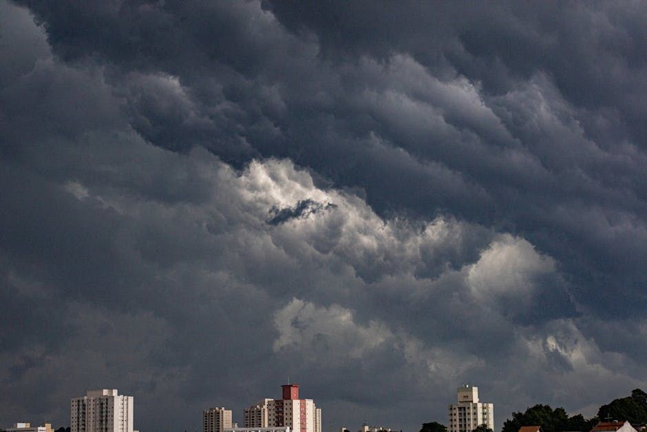
Ottawa and the surrounding area are under a thunderstorm watch issued by Environment Canada, with forecasters warning that conditions could turn dangerous as the storm system moves through the region. The watch covers potential wind gusts ranging from 90 km/h to 110 km/h — strong enough to down trees, snap branches, and send unsecured outdoor furniture flying.
What to Expect
Environment Canada's alert outlines a range of hazards that residents should be prepared for:
- Damaging wind gusts between 90 and 110 km/h
- Large hail up to the size of ping-pong balls
- Possible tornado activity in the watch zone
These aren't just blustery showers — gusts at that speed can cause significant property damage, knock out power, and make driving extremely hazardous. Hail that size can dent vehicles, break windows, and damage roofs.
Stay Storm-Ready
If you're in Ottawa or the surrounding communities, now is the time to take a few simple precautions before the storms hit:
- Bring in or secure patio furniture, planters, umbrellas, and anything else that could become a projectile in high winds
- Avoid parking under trees or near structures that could be damaged
- Charge your devices in case of power outages
- Check on neighbours who may need help, especially older adults or those with mobility challenges
- Keep an eye on alerts via the Weather Network app or Environment Canada's online portal
If you're caught outdoors when a storm hits, seek sturdy shelter immediately. Stay away from windows, and if you hear thunder, head inside — lightning can strike well before the rain arrives.
Tornado Watch: What It Means
It's worth clarifying: a watch means conditions are favourable for tornado development, not that one has been spotted. If a warning is issued — meaning a tornado has been confirmed or is imminent — you should take immediate shelter in the lowest floor of a sturdy building, away from windows.
Ottawa has experienced tornadoes before. The September 2018 tornadoes that tore through Dunrobin and Gatineau are a stark reminder that the Ottawa Valley can be vulnerable to severe rotating storms. While the vast majority of thunderstorm watches don't produce tornadoes, it's always smart to know your plan.
Power Outage Preparedness
Hydro Ottawa customers should be ready for potential outages. It's a good idea to have a flashlight, bottled water, and a portable battery bank on hand. Outages can be reported through Hydro Ottawa's website or app, and their crews typically move quickly to restore service after storm events.
Keep Monitoring
Environment Canada updates watches and warnings frequently as storm systems evolve. The situation can change quickly — what's a watch now could be upgraded to a warning with little notice. Check the Environment Canada website or your local weather app regularly for the latest updates throughout the day.
Stay safe, Ottawa — and maybe hold off on that backyard BBQ until the skies clear.
Source: Ottawa Citizen / Environment Canada. Original article at ottawacitizen.com.